
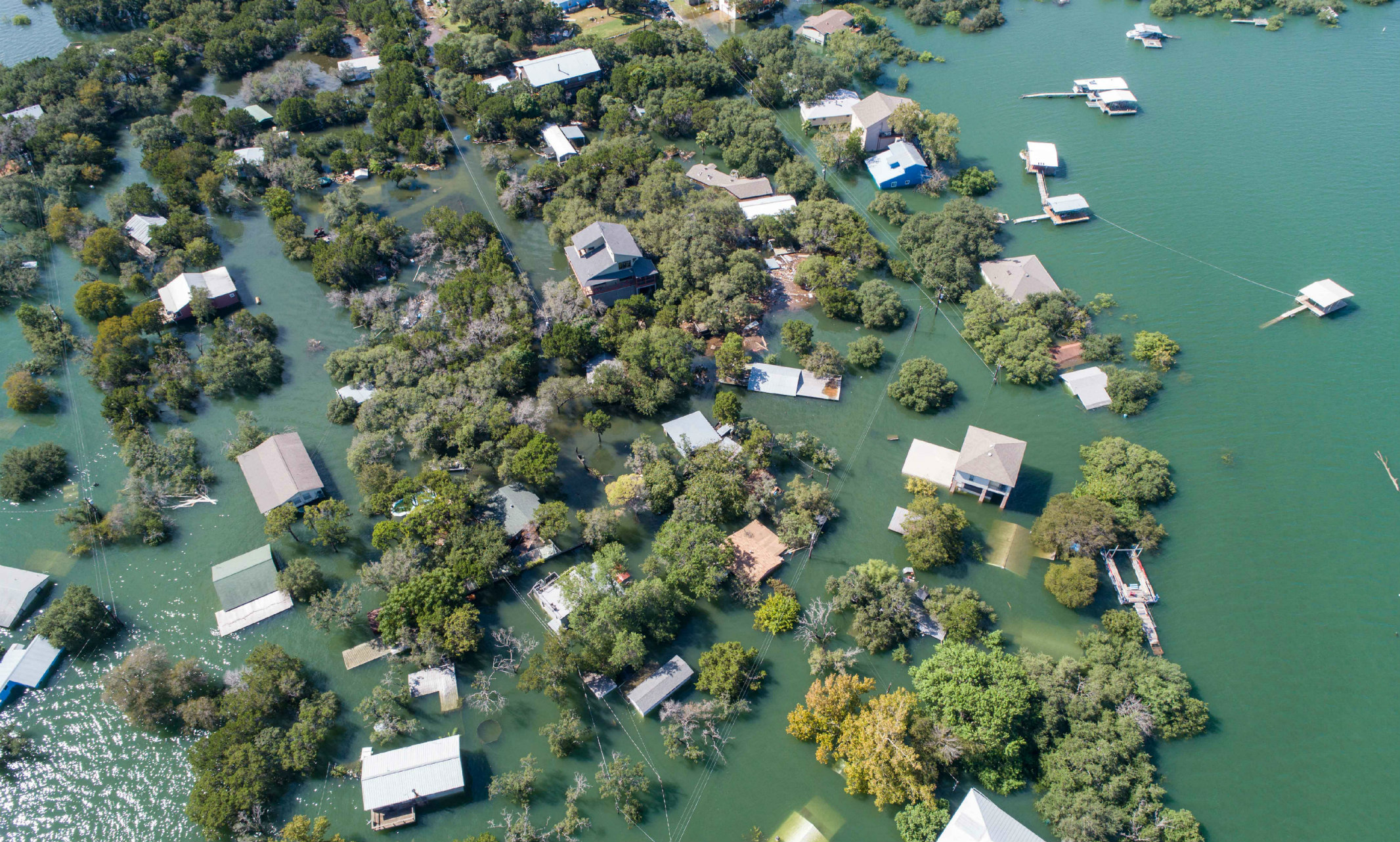
Imagine you’re receiving multiple calls about dangerous levels of floodwater damage, and your job is to prioritize relief efforts. Now imagine you have a statistical map telling you exactly where the damage will be worst. Creating solutions for real-world disaster-relief situations is the primary focus of the research of ZhiQiang Chen, Ph.D., associate professor of civil and mechanical engineering.
Chen is part of a growing field of research that he refers to as “disaster informatics.” That is, harnessing the power of cuttingedge technology and using it to respond to natural disasters. His research is part of a much larger collaboration between several entities, including the NASA Jet Propulsion Lab, University of Indiana, Oak Ridge National Laboratory, ImageCat in California and Pacific Disaster Center in Hawaii.
Chen’s piece of the puzzle has to do with artificial intelligence (AI)-based computing of remote sensing data for global flood-hazard monitoring and damage assessment. His ultimate goal is to develop a program that automatically creates 3D renderings that clearly show damage and provide decision-makers with stats about damage levels in real time.
“When I first started this research, it was a very small field,” Chen says. “However, the increased frequency and severity of natural disasters is attracting more people to this field.” Currently, images of disaster areas are typically taken by satellite, but Chen imagines drones being used more regularly. In theory, a drone could fly over a damaged area, collect an image and either process the image with an edge computing system or send the data to a ground center to be processed. Then a 3D rendering would be sent directly to first responders to help them quickly prioritize areas with the greatest damage.
Chen’s first opportunity to test his research’s potential was in the aftermath of the 2019 tornado in Jefferson City, Missouri, through support from the Structural Extreme Events Reconnaissance (StEER) program of the National Science Foundation. In the days following the tornado, he and his team flew a drone over an apartment complex to collect images of the damage.
He then processed the data and produced two images: one was an orthomosaic image — stitched together from multiple images — and the other was a digital surface model, showing the volume change of each structure. These final products were then fed to an AI-based model to determine the extent of the damage to each of the buildings in the apartment complex.
In Jefferson City, Chen used only one drone, but during the 2017 total solar eclipse, he was able to test the use of multiple drones. Local law enforcement officers and emergency responders in St. Joseph, Missouri, had expressed concern over traffic congestion.
With a group of about 20 residents and a total of 10 drones, Chen and his team collected images and funneled them to a single location for processing. Local officials received the final outputs on iPads and used the images to assess traffic throughout the day. “With this experience, we confirmed the notion of community-based, connected remote sensing where citizen scientists can participate in disaster response and provide key input to first responders,” he says.
"When I first started this research, it was a very small field. However, the increased frequency and severity of natural disasters is attracting more people to this field."
While it is exciting to see the potential of Chen’s research, there is one major obstacle to overcome. Aviation regulations require approval to fly in order to maintain safe and open airspaces for other aircraft like medical helicopters. Currently, there are not many ways for helicopters and other aircraft to identify a flying drone in their airspace. The new Unmanned Aircraft Systems (UAS) Remote Identification Program may soon resolve this issue, opening up the civilian market for use in projects like this.
Another equally important challenge is the nature of disaster response in general. With so many social factors at work, the application may not be straightforward. Chen stated that at a certain point this research will have to become interdisciplinary in order to study social implications and how they affect implementation.
“For me, the greatest success would be to see my research being used to make a difference and help people when they need it most,” Chen says. “The possibility that my research could someday become a regular part of disaster relief is what fuels my passion for this work.”