

It was 3:03 a.m., February 4, 1976. While Guatemala’s citizens slept, the country’s massive Motagua Fault ruptured. In 39 seconds, the resulting 7.5 magnitude earthquake had devastated this Central American nation.
Nearly five decades later, a research team from University of Missouri-Kansas City, in collaboration with U.S. and Guatemalan partners, is investigating the country’s extensive geohazards, including the Motagua Fault.
An International Investigation
The Guatemala GeoHazards International Research Experiences for Students was launched in early January 2023. A long-term vision of director Tina Niemi, this three-year program gained funding in late 2022 from the National Science Foundation.
“Understanding the seismic potential of Guatemala’s active fault systems and volcanic history are key goals of the program,” said Niemi, Ph.D., professor of geology and a Curators’ Distinguished Teaching Professor. “This year, we investigated the earthquake history of the Motagua Fault.”
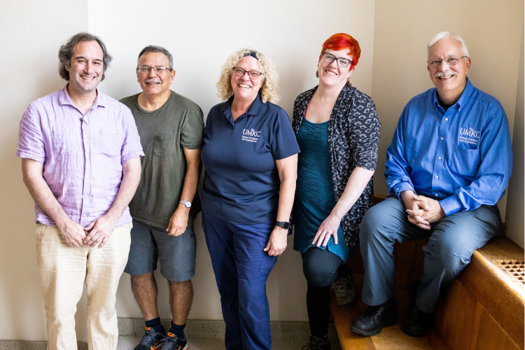
The 2023 Guatemala Geohazards field team included 10 U.S. and Guatemalan students, three faculty mentors from UMKC and the University of Missouri, two Guatemalan faculty and one industry mentor.
During this inaugural International Research Experiences for Students program, the group conducted research across several disciplines of geoscience, including volcanology, paleoseismology, surficial processes and geospatial data science. Together, the cohort completed three and a half weeks of field research in Guatemala, followed by a break for preliminary analysis and sample processing. In May, the group reconvened for two weeks of lab work and data analyses at at UMKC and virtually.
“Through this program, students receive an authentic research experience that includes mentorship by faculty from the U.S. and our partner universities in Guatemala,” Niemi said. “They not only increase their scientific inquiry and research skills but practice international collaboration.”
The International Research Experiences for Students faculty are all specialists in geology fields, including the study of Guatemala’s geohazards. With guidance from their mentors, the students collaborate in the scientific process. They develop questions, collect, analyze and interpret data and then present that data.
They also navigate the challenges of international field research.
“These are not controlled experiences,” Niemi said. “There are many uncertainties, such as access permission, weather conditions and malfunctioning equipment, to name a few. Field research requires flexibility and adaptation to the conditions — all valuable life skills.”
Aleigha Dollens (B.S. ’24) participated in the inaugural geohazards program to gain field experience that augments her classwork.
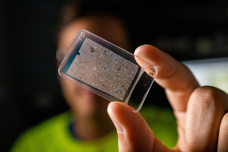
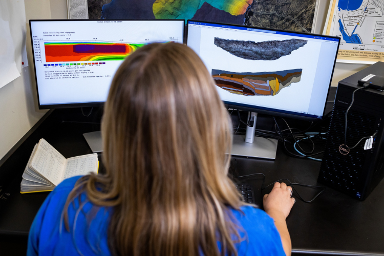
“I worked closely with mentors and learned hands-on how to do research,” said Dollens, whose own research focuses on geophysical imaging of the subsurface of the Motagua Fault.
“I was in a small research group where I asked questions and received feedback from the program’s professors. I’m now more confident in my ability to practice research and in myself as a person.”
Guatemala’s Geohazard Vulnerability
Ranked fourth globally for geohazard disaster risk, Guatemala is continuously exposed to multiple hazards, including earthquakes, volcanic eruptions, landslides, floods and storms. These geohazards threaten countless lives, environmental stability and economic infrastructure.
The 1976 Motagua earthquake, one of innumerable Guatemalan natural disasters, resulted in 23,000 deaths and 74,000 injuries. One million people were displaced — nearly one-fifth of Guatemala’s population at the time. Thousands of aftershocks exacerbated the destruction and resulted in economic damages estimated at 17.9% of the country’s gross domestic product.
These geohazards do not always occur independently, and interactions between hazards often trigger multiple secondary hazards. In recent years, new geohazards have emerged in Guatemala, while existing hazards have intensified.
Omar Beltetón, Ph.D., a professor and researcher at the Higher Studies Center for Energy and Mines and an engineering faculty member at the University of San Carlos, believes information and insight from the UMKC collaboration and investigation will contribute to Guatemala’s development of strategic geohazard resilience.
“Subsidence and sinkholes have formed in streets or highways and caused the collapse of storm drainage pipes,” said Beltetón, an International Research Experiences for Students faculty member from Guatemala. “These are consequences of climate change and urban flooding because of inadequate infrastructure design. Road collapse and landslides in mountainous areas are the result of deforestation and the consequent erosion."
“This research is significant because of our country’s geographic and tectonic setting. The Guatemalan people haven’t been able to escape the suffering from geohazards, including loss of life, infrastructure damage and economic loss. We must try to understand the phenomena to avoid these losses.”
Exploring With 21st-Century Technology
The Guatemala GeoHazards program uniquely utilizes both traditional geologic field mapping and cutting-edge technology, such as LiDAR (Light Detection and Ranging) drone imaging.
Small but mighty, LiDAR drones are valuable research partners.
“The basic approaches for investigating geohazards have been established for some time, but a significant limitation has been observational capability,” said Francisco Gomez, Ph.D., geological sciences professor at the University of Missouri and the UMKC program’s surficial processes research team mentor. “New technologies provide us with unprecedented views of the earth to push our investigation further.”
“As recently as 25–30 years years ago, earthquake investigations and landslide mapping primarily involved traditional terrestrial surveying. Though accurate, these methods are time-consuming and expensive. Today, unmanned aerial systems provide higher resolution information at a much lower cost. Also, drone images allow us to see subtle tectonic features not otherwise easily visible. It’s a game-changer we could only dream about previously.”
These advancements yield significant, beneficial data about geohazards.
“Some of the most exciting results come from interpretation of the LiDAR data we acquired across the 1976 earthquake rupture trace,” said Niemi, who is a Quaternary geologist specializing in geoarchaeology, sedimentology and active tectonics. “We identified features revealing accumulative offset that can be used to determine the fault’s slip rate. Slip rate is a critical parameter in seismic hazard assessment.”
Mitigation Insights and Strategies
The potential for this research is far-reaching — and sharing the results with other scientists and organizations in Guatemala is a vital component of the work.
“While our number one goal is to educate the next generation in geohazard research, the data we collect have profound significance in defining the occurrence or repeat time of earthquakes and volcanic eruptions,” Niemi said. “Key parameters for seismic and volcanic hazards collected through the program are essential to government preparedness plans and mitigation strategies.
“For example, our volcanology research team began mapping pyroclastic flow deposits from the Chocoyos volcano that occurred 75,000 years ago. This research is the first step to help better constrain future volcanic hazards.”
In Guatemala, the program’s research is in collaboration with the University of San Carlos de Guatemala’s Center for Higher Studies of Energy and Mines and the Centro Universitario del Norte’s Department of Geology. Information from the program can be incorporated in the National Seismic Design Code, which specifies structural safety standards and guidelines for reinforcing existing works.
Results will also be shared with the Guatemalan Association of Structural and Seismic Engineering, the National Coordinator for Disaster Reduction and the Institute of Seismology, Volcanology, Meteorology and Hydrology — the primary governmental institution that monitors geological hazards.
“Our collaboration with UMKC helps us to understand geohazard phenomena in a way that action can be taken to help minimize their impact and help ensure that losses and damage are minimal,” Beltetón said. “The investigation establishes possible danger zones for geohazard threats and the feasibility of building on specific sites. The research also guides the preparation of hazard maps and is a tool for territorial ordering, a mode of land-use planning with an emphasis on conservation.”
Looking to the Future
At the conclusion of the International Research Experiences for Students Program, student participants wrote a scientific abstract and presented their findings at the UMKC’s Guatemala GeoHazards poster symposium. Some will also present their research at this year’s annual meetings of the Association of Environmental and Engineering Geologists (AEG) and the Geological Society of America.
Dollens is one of the students who will present at the AEG conference.
“This program has inspired me to get my master's degree at UMKC and kickstarted my research skills and career as a professional. I’ll always be grateful for the opportunity to work on this project and for the relationships I built with the team,” said Dollens, recipient of a 2023 Summer Undergraduate Research Opportunity award.
She was also awarded the prestigious 2023 Richard Hay Award from the Geological Society of America for her research on evidence of earthquakes at the Quirigua archaeological site in Guatemala. A full circle moment, Niemi was the first recipient of this award 34 years earlier.
These collaborative connections made today and for the future are integral to Niemi’s vision for the program.
“Research is the exploration of the unknown,” Niemi said. “The shared experience of students and mentors exploring geology in the field provides a unique setting that emphasizes inquiry and builds confidence. In this rich learning environment, students observe mentors from different countries discussing geology and modeling the fundamental first step in research — asking questions.
“We’re dedicated to educating the next generation of scientists, diversifying the workforce and promoting societally relevant research that can be translated into solutions.”